The Prangin Canal area, also known as Sia Boey or Kalla Kadai (in Tamil), was a prominent and memorable area feature in the public space of George Town. Flanked by Prangin Road and Maxwell Road (now Jalan Dr Lim Chwee Leong and Jalan Magazine), it formed the southern boundary of George Town and now the true boundary of George Town World Heritage Site.
Originally Prangin River, it was canalised in 1804 as a response towards the ongoing Napoleonic Wars happening in Europe. To protect the town on the landward side, the canal was further extended and connected to Transfer Road to isolate the administration centre of Tanjung; and this was referred to as the Bound Ditch.
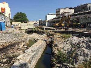
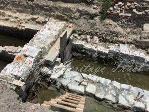
In 1882, plans were drawn up to improve the Prangin Canal area and included the installation of sluice gates and narrowing of the canal. Land was also isolated and the Prangin market (between 1882 and 1891) was constructed using a prefabricated cast-iron frame shipped from Derby and London.
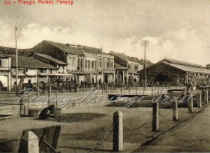
The market and its surrounding area flourished, and at its peak saw prominent features such as bus terminal, schools, shopping area and an amusement park (Great World). The canal was also an important waterway as goods were brought up via the canal and distributed to businesses around Penang Road, Beach Street and Carnarvon Street. The vibrancy survived for over 140 years before parts of the canal was covered up , hidden underneath malls, people evicted from the surrounding houses following the repeal of Rent Control Act, and the market’s relocation to Macallum Street Ghaut.
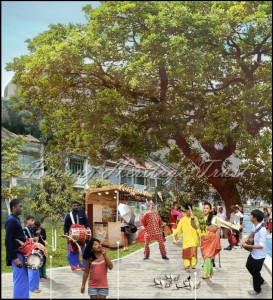
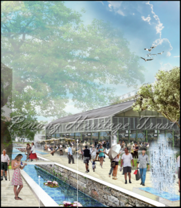
In the past few years, several ideas were mooted to restore the vibrancy and life back to Prangin canal and its surrounding areas. Plans were drawn up to redevelop Phase V of KOMTAR (Prangin canal and the surrounding shophouses and amenities) into an open space, arts and culture district that seeks to blend the rich social values, cultural memory, tangible and intangible heritage into a modern day inclusive area for George Town’s urban generation.
Penang Development Corporation (landowner for KOMTAR development, including Phase V) had also undertaken research to substantiate the rich history of the canal. In early 2016, an archaeological team had discover the old sluice gates constructed in the canal, as well as fragments and shards of pottery that provides us with a glimpse into the history of the canal.
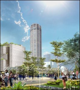
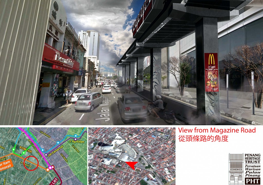
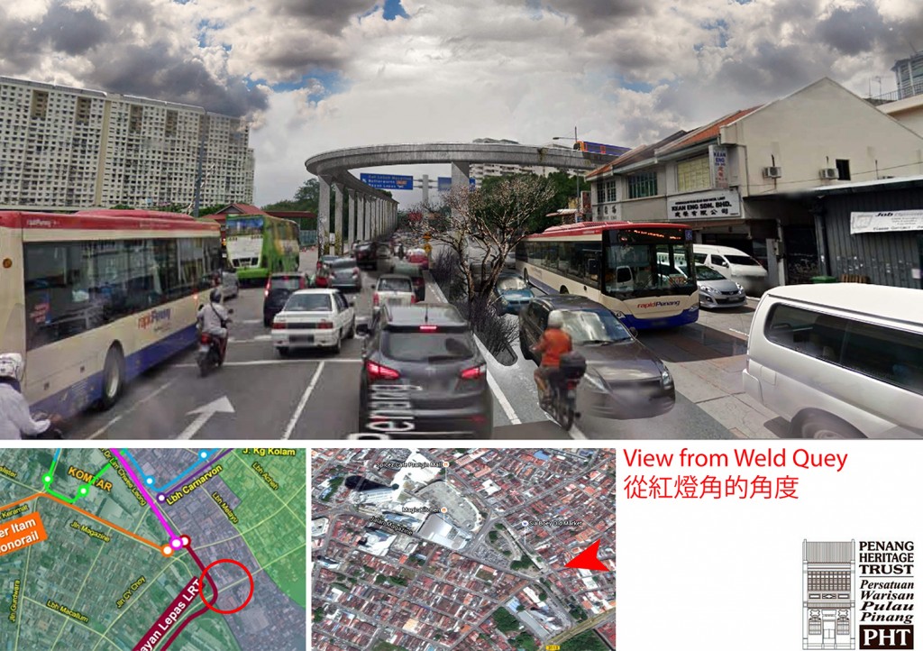
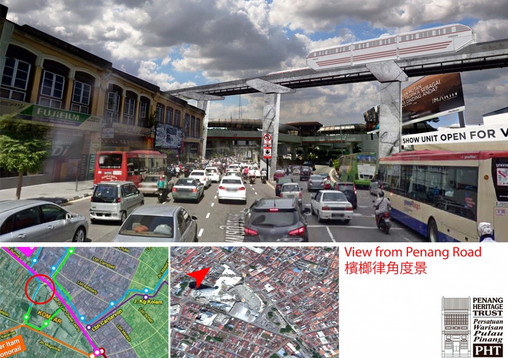
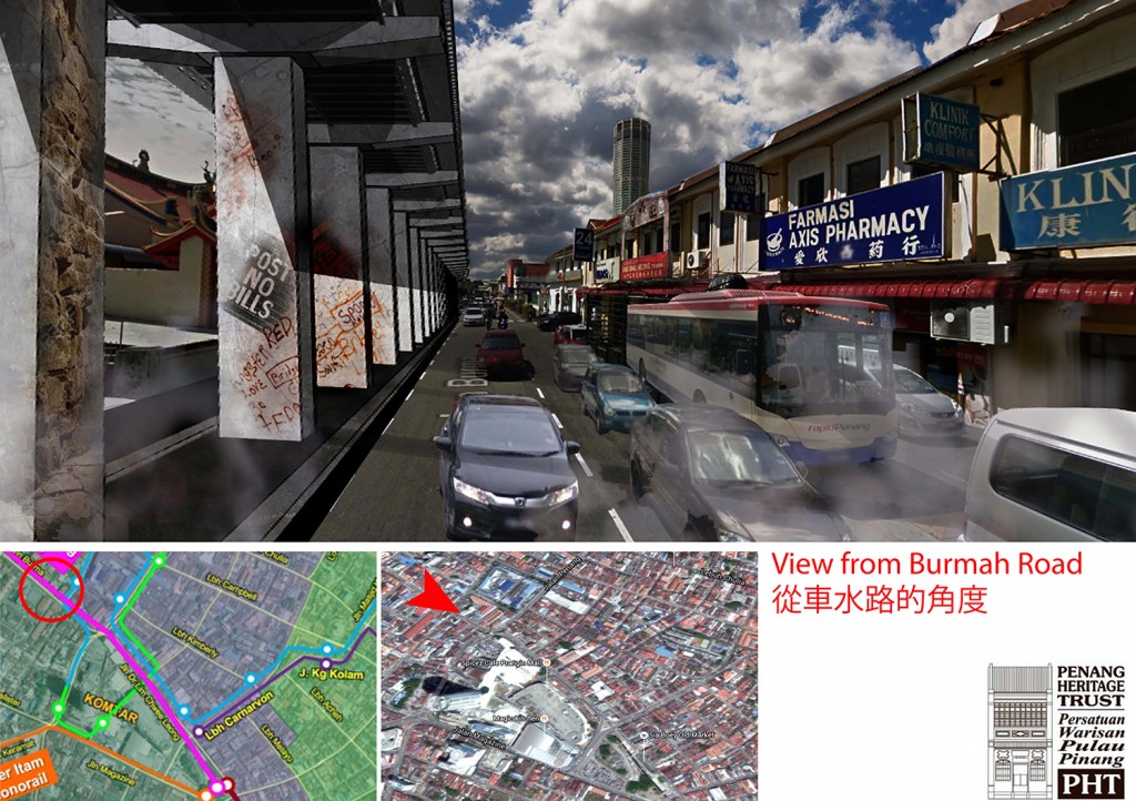
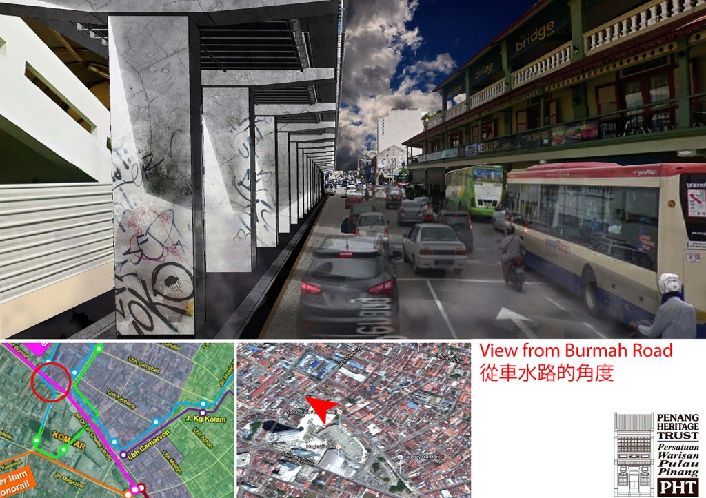
However, all will be for naught as the Penang Transport Master Plan had proposed for the area to be transformed into the Integrated Exchange Hub, servicing two monorail lines (George Town to Air Itam, George Town to Tanjung Tokong) and a Light Rail Transit (LRT) line (George Town to Bayan Lepas and the 3 man made island off Gertak Sanggul). The proposed trams that serve the inner city may also be connected to the Hub, but artist impressions have suggested otherwise.

We now question the need for such massive development just to manage the traffic and transport issues within Penang. The plan costs RM27 billion, while implementation may cost RM40 billion or more. Included in the plan are coastal reclamation of three islands off Gertak Sanggul, the reclamation off the north coast at Gurney Drive, the construction of an underwater tunnel that connects to the northern region of Seberang Perai etc.
We also question the lack of vision in the Penang Transport Master Plan. Aside from the major constructions, no thought or foresight has been given towards the streetscape, pedestrian accessibility, tangible and intangible heritage and other values associated with the land. Age old trees will have to make way for the monorail lines, buildings will have to be torn down to facilitate the construction of stations, and livelihood of traditional fisherfolk and our natural resources will be compromised.

![]()
![]()
![]()
![]()
Are we ready to accept such a plan? Are we ready to have Prangin area, including its canal, covered up for the construction of the hub, and possibly other high rise buildings such as parking bays? Are we ready to sacrifice Prangin area and turn it into KL Sentral? Do we embrace all kind of development, even though it is unsympathetic to the locus genii of the area?
Do take your time to see the visuals, understand the possible impacts, and then provide your feedback to the Penang Transport Master Plan official website.

Disclaimer: All images are used with permission from the respective owners, and were previously featured in the PHT talk entitled Prangin Canal – The Promised People’s Park?